




- Why Route 66 Still Matters
- Need to Drive the Whole Route 66 Road Trip
- Chicago to St. Louis
- Oklahoma Through the Texas Panhandle
- New Mexico to Santa Monica
- Navigating When Route 66 Splits From the Interstate
- What to Rent for the Desert Sections
- Final Thoughts on Planning Your Drive
- Frequently Asked Questions
Why Route 66 Still Matters?
Before the interstate highway system replaced it in the 1970s, Route 66 was the main artery for anyone driving west. Migrant families in the 1930s used it to reach California’s farmland. Truckers and traveling salesmen kept its diners and motor courts in business through the 1950s. When it was decommissioned in 1985, entire towns that depended on it went quiet almost overnight.
That history is why the road still pulls travelers back. You are not just driving from point A to point B, you are following the same path that carried hope, desperation, and eventually American car culture west. Knowing that context makes a faded motel sign or a boarded up gas station feel like something worth stopping for, not just a photo op.
Stay Online Through the Desert Stretch
Keep live navigation working across state lines with no dead zones or roaming bills
Do You Need to Drive the Whole Route 66 Road Trip?
Full disclosure: almost nobody drives all 2,448 miles of Route 66 in one trip, and you do not need to either. Most travelers pick two or three sections that deliver the strongest mix of history, scenery, and roadside culture, then connect them using interstate highways for the less remarkable stretches in between.
The three sections that consistently deliver the mythological version of Route 66, neon motels, desert horizons, small diners that have not changed their menu since 1962, are Chicago to St. Louis, Oklahoma through the Texas Panhandle, and New Mexico through Arizona into Santa Monica. If you only have a week or two, building your route 66 road trip around these three stretches gives you the highlights without the filler.
Chicago to St. Louis: Neon Lights and Roadside Architecture
This is the section where Route 66 still looks like the movies. Illinois preserved more of its original neon signage than any other state on the route, and driving it after dark is genuinely worth planning around. Stops worth building your day around include:
- The Gemini Giant in Wilmington, Illinois, a 28-foot fiberglass spaceman outside a former diner
- The Ariston Cafe in Litchfield, one of the oldest continuously operating restaurants on the entire route
- Chain of Rocks Bridge on the Illinois-Missouri border, with its distinctive mid-span bend over the Mississippi River
- The Route 66 Neon Heritage District in Springfield, Illinois, best seen at dusk when the signs light up
Budget two to three days for this stretch if you want to actually stop at these places rather than photograph them through the windshield. It pairs well with a broader look at renting and driving across the US if this is your first cross-country drive.
Oklahoma Through the Texas Panhandle: The Heartland Stretch
This section is quieter, and that is exactly the point. Small town Oklahoma and the Texas Panhandle show Route 66 without the tourist polish, gas station attendants who still ask where you are headed, cafes where the specials board has not been updated in years, and long stretches where you genuinely do not see another car.
The anchor stop here is Cadillac Ranch, just west of Amarillo, ten Cadillacs buried nose down in a field and covered in decades of visitor graffiti. Bring your own spray paint, it is expected. Beyond that, look for the Blue Whale of Catoosa near Tulsa and the Round Barn in Arcadia, Oklahoma. This stretch is genuinely moving in a way the more photogenic sections are not, because it feels lived in rather than preserved for tourists.
Check out our plans
-

Mexico 10 Days Unlimited
USD 29.00 -
Mexico 15 days 6GB
USD 17.00 -
Mexico 15 Days Unlimited
USD 39.00 -
Mexico 3 Days Unlimited
USD 12.00 -
Mexico 30 days 10GB
USD 19.00 -
Mexico 30 days 20GB
USD 36.00
New Mexico to Santa Monica: Desert and Canyon Drive
This is the section people picture when they imagine Route 66: open desert, red rock, and a highway that seems to disappear into the horizon. It is also the most cinematic, and worth the extra driving time it demands.

Key stops to build around:
- The Blue Hole in Santa Rosa, New Mexico, an 80-foot deep natural spring popular with divers and swimmers
- Petrified Forest National Park in Arizona, where ancient fossilized logs are scattered across the desert floor
- The Painted Desert, which borders the park and is best photographed in the late afternoon light
- The Wigwam Motel in Holbrook, Arizona, where you can actually sleep in a concrete teepee
- The Santa Monica Pier, the official western terminus, where most travelers take their final photo under the End of the Trail sign
This is also the section where distances between fuel stops get longer, so plan gas stops more deliberately than you would on the earlier legs.
Never Miss the Old Alignment
Catch every historic detour off the interstate with real-time data on your phone
Navigating When Route 66 Splits From the Interstate
Here is the part most first time drivers underestimate: Historic Route 66 is not one continuous, clearly marked road. It frequently splits away from Interstate 40, runs parallel for stretches, dead ends without warning, and reappears under a different name a few miles later. Standard GPS apps default to the interstate because it is faster, which means they will often route you straight past the old alignments where the actual roadside attractions sit.
Finding the good detours, the ones with the neon signs and the small diners, requires checking real-time map data as you go, not just following the fastest route your app suggests. This is genuinely part of the adventure once you know to expect it, but it means you need a reliable connection the entire drive, not just in cities. A dead phone or no signal in rural Oklahoma or the New Mexico desert means missing turns you cannot easily backtrack to find.
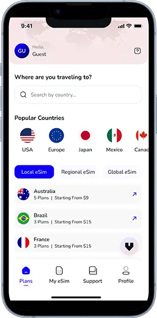
This is where a USA road trip eSIM coverage guide becomes genuinely useful rather than optional. A Voye Global eSIM keeps your navigation apps working with live data across state lines, so you can actually catch the old alignment before you have driven ten miles past it on the interstate. It is also worth reading up on using Google Maps without internet as a backup for the more remote stretches where signal briefly drops.
When Should You Go?
Timing your route 66 road trip around the weather matters more than most people expect, especially for the desert sections. April through May and September through October are the sweet spot. Daytime temperatures in Arizona and New Mexico stay manageable, and you avoid both the brutal summer heat, which regularly tops 100°F in the desert stretches, and winter conditions that can bring snow to higher elevation sections like Flagstaff.
Summer is not impossible, but you will want to start driving early and plan your longest desert legs for the cooler morning hours. If your schedule is flexible, shoulder season also means fewer crowds at stops like Cadillac Ranch and the Painted Desert.
Cross State Lines Without Losing Signal
One eSIM covers Illinois to California so your maps stay live the whole drive
What to Rent for the Desert Sections?
A compact sedan is fine for the Chicago to St. Louis leg, but once you hit the Texas Panhandle and the desert stretches, a full-size car or SUV is the better call. You get more ground clearance for the occasional unpaved detour off the historic alignment, more comfortable long-distance seating, and a bigger fuel tank, which matters on the longer gaps between gas stations in New Mexico and Arizona.
Book your rental with unlimited mileage if it is offered. A proper route 66 road trip covers far more distance than a typical vacation rental car estimate accounts for, especially once you factor in detours off the interstate to chase the old alignments.
Final Thoughts on Planning Your Drive

You do not need three weeks and a full tank of nostalgia to do Route 66 justice. Picking the Chicago to St. Louis neon corridor, the Oklahoma and Texas Panhandle heartland stretch, and the New Mexico to Santa Monica desert run gives you the road’s full emotional range, its architecture, its quiet authenticity, and its cinematic finish, in a trip that fits a realistic vacation. Pack a paper map as backup, but plan to lean on live navigation data to catch the detours worth taking, and time your drive for spring or fall so the desert sections stay comfortable.
If long American road trips are becoming a pattern for you, it is worth comparing notes with other stateside drives, including a first-timer’s guide to Yellowstone National Park, which pairs well with a Route 66 detour through the Southwest on the same trip.
Frequently Asked Questions
Yes, most of Route 66 is still drivable, though it was decommissioned as an official highway in 1985. Large portions survive as state highways, county roads, or business loops running parallel to Interstate 40 and other interstates, often with brown Historic Route 66 signage marking the original alignment.
Driving all 2,448 miles from Chicago to Santa Monica typically takes two to three weeks if you stop at major attractions along the way. A faster pass focused only on driving takes about a week, but most travelers instead pick two or three strongest sections and complete a shorter route 66 road trip in seven to ten days.
Route 66 crosses eight states: Illinois, Missouri, Kansas, Oklahoma, Texas, New Mexico, Arizona, and California. Each state preserves different amounts of the original alignment, with Illinois and Arizona generally having the best-marked historic sections for travelers to follow.
John Steinbeck coined the term Mother Road in his 1939 novel The Grapes of Wrath, describing how the highway carried Dust Bowl families from the Midwest to California during the Great Depression. The name stuck because it captures the road’s role as a literal lifeline, not just a scenic drive.
April through May and September through October are the best months for a route 66 road trip. These shoulder seasons avoid the extreme summer heat in the Texas Panhandle and Arizona desert sections, while also sidestepping winter snow risk at higher elevations like Flagstaff.
A full Route 66 trip typically costs $1,500 to $3,000 per person for one to two weeks, covering a full-size rental car, gas, budget to mid-range motels, and meals. Costs drop significantly if you focus on just one or two of the strongest sections instead of the full route.
Route 66 no longer exists as a single official highway on modern maps, but its alignments are marked as Historic Route 66 on most mapping apps and physical road signage. Because it frequently splits from the interstate, live map data is essential to actually follow the historic path rather than the faster modern route.
Start by picking two or three of the strongest sections rather than the entire 2,448 miles, book a full-size car or SUV for the desert legs, and travel in spring or fall. Keep a reliable data connection running throughout so your navigation app can catch the historic detours off the interstate.

Seamless Mobile Data Everywhere













 English