


Note that iPhone devices from Mainland China aren’t eSIM compatible. Also iPhone devices from Hong Kong and Macao aren’t compatible (except for iPhone 13 Mini, iPhone 12 Mini, iPhone SE 2020 and iPhone XS)
Explore Lukomir, Prenj, Visočica & Beyond
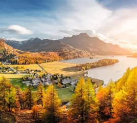
Bosnia and Herzegovina is a dreamland for hikers. It offers dramatic peaks, pristine rivers, glacial lakes, and traditional mountain villages—all without the crowds you’ll find in other European destinations. Whether you’re chasing panoramic views, exploring Ottoman-era paths, or hiking through alpine meadows, Bosnia’s trails are as culturally rich as they are physically rewarding.
Here are the top hiking trails you shouldn’t miss, including the rugged beauty of Lukomir, the untamed wilderness of Prenj, and the panoramic ridges of Visočica.
Stay Connected While Hiking
Use offline maps, weather alerts, and location tools easily.
1. Lukomir to Umoljani Trail
Difficulty: Moderate
Distance: ~16 km round trip
Duration: 5–6 hours
This is arguably the most famous day hike in Bosnia, connecting two traditional mountain villages—Lukomir and Umoljani—perched on the Bjelašnica Plateau. Lukomir is the highest and most isolated permanent settlement in the country, where time seems to stand still.
Trail Highlights:
- Steep canyons of the Rakitnica River
- Traditional stone-roofed homes in Lukomir
- Watermills and ancient stećci (medieval tombstones)
- Easy to access from Sarajevo as a day trip
Best for: Cultural hikers and photographers who want views and heritage in one loop.
2. Visočica Mountain Traverse

Difficulty: Moderate to Challenging
Distance: Varies (popular route: Vito Peak loop ~14 km)
Duration: 6–8 hours
Bordering Lukomir and the Rakitnica Canyon, the Visočica range is a hiker’s paradise with panoramic ridge trails, sharp limestone peaks, and wide alpine pastures. Vito (1,960m) is a popular summit offering 360° views of Bjelašnica, Prenj, and the canyon below.
Trail Highlights:
- Remote ridgelines with dramatic drop-offs
- Rare wildflowers and mountain wildlife
- Stunning views into the canyon carved by Rakitnica
- Wild camping options
Best for: Experienced hikers wanting quiet, high-altitude trails near the capital.
3. Prenj Mountain (Herzegovinian Alps)
Difficulty: Challenging
Distance: Depends on the summit (e.g., Zelena Glava: ~18 km)
Duration: 7–10 hours or multi-day
Known as the “Bosnian Himalayas,” Prenj is remote, wild, and seriously underrated. Its jagged limestone peaks and technical ridgelines are reserved for well-prepared trekkers. The area is best explored over several days via high huts or guided multi-day expeditions.
Trail Highlights:
- Sharp peaks like Zelena Glava (2,155m) and Otiš (2,094m)
- Challenging ascents and rocky scrambles
- Hidden glacial valleys and untouched alpine ecosystems
- Huts like Rujište or Jezerce used as base camps
Best for: Veteran hikers, mountaineers, or groups with a local guide.
15% Off Your eSIM Plan
Use code VOYE15 to save on data while exploring Bosnia.
4. Maglić & Perućica Rainforest (Sutjeska National Park)

Difficulty: Moderate to Challenging
Distance: ~20 km round trip to Maglić summit
Duration: Full-day hike (~8–9 hours)
Located in Sutjeska National Park, Maglić (2,386m) is Bosnia’s highest peak. The trail offers a rare combination of mountain and forest trekking, with sections passing through the ancient Perućica Rainforest, one of Europe’s last primeval forests.
Trail Highlights:
- Stunning Trnovačko Lake (technically in Montenegro)
- Dense rainforest paths with moss-covered trees
- Steep final ascent to Maglić summit
- Panoramic views over Bosnia and Montenegro
Best for: Nature lovers, serious trekkers, and photographers.
5. Treskavica Mountain Trails
Difficulty: Moderate to Challenging
Distance: Varies (e.g., Veliko Jezero loop ~15 km)
Duration: 5–8 hours
South of Sarajevo, Treskavica offers crystal-clear mountain lakes, jagged peaks, and an off-the-beaten-path atmosphere. It’s less visited than its neighbours, making it ideal for hikers looking to escape.
Trail Highlights:
- Lakes like Veliko Jezero and Crno Jezero
- Quiet, less-crowded trails
- WWII historical remnants along the path
- Chance to spot chamois and wild boar
Best for: Hikers seeking solitude and unspoiled nature.
6. Čvrsnica – Hajdučka Vrata Trail

Difficulty: Moderate
Distance: ~17 km round trip
Duration: 6–8 hours
The iconic Hajdučka Vrata (Outlaw’s Gate) is a natural stone arch sitting at the edge of a dramatic cliff in the Čvrsnica range. The trail starts from the Vilino Kolo area or Blidinje Nature Park and offers a mix of forest and alpine trekking.
Trail Highlights:
- One of the most photogenic spots in Bosnia
- Views of Čvrsnica peaks and glacial valleys
- Stories of hajduks (rebels) who once hid in these ranges
Best for: Instagram-friendly hikers and fans of highland folklore.
7. Romanija Plateau & Orlovača Cave
Difficulty: Easy to Moderate
Distance: Shorter loops available
Duration: 2–4 hours
Ideal for beginner hikers or those travelling with families, Romanija offers pine-covered hills, caves, and wide meadows with views stretching to Jahorina and beyond. The nearby Orlovača Cave adds a touch of speleology to your hike.
Best for: Half-day hikes and family trips.
Bonus: Via Dinarica Trail (Bosnian Section)

Distance: 300+ km in Bosnia
Duration: Multi-day or section hikes
Bosnia’s portion of the Via Dinarica White Trail passes through much of the country’s most scenic landscapes—from Blidinje to Sutjeska to Jahorina. It’s a long-distance route suitable for seasoned trekkers or those looking to hike in segments.
Hiking Tips for Bosnia and Herzegovina
- Check trail conditions. Some areas may still have landmine risks—always stick to marked routes.
- Hire a guide for remote trails like Prenj and Maglić.
- Weather changes fast. Carry a jacket even in summer.
- Public transport is limited. Rent a car to reach trailheads.
- Start early. Many trails are exposed to sun and can get hot by midday.
- Stay hydrated. Bring enough water, especially in higher elevations.
Stay Connected on the Trails with Voye Global
Exploring Bosnia’s remote mountain ranges requires more than sturdy boots and good weather—you’ll also need reliable connectivity. Whether you’re navigating trail maps in Prenj, checking elevation on Visočica, or sharing a panoramic photo from Lukomir, Voye Global ensures you’re never out of touch.
Why Choose Voye for Bosnia and Herzegovina?
- Instant eSIM activation—no physical SIM needed
- Coverage across remote and urban zones
- Secure, fast data for weather updates and map use
- No contracts or roaming charges
- 100MB free trial you can test before leaving home
- Compatible with all major eSIM-ready smartphones
With Voye Global’s Bosnia eSIM, hikers can confidently venture into Bosnia’s highlands without worrying about getting lost, disconnected, or dependent on patchy Wi-Fi. Just scan, activate, and you’re online—ready to trek with confidence.
Explore Remote Trails Smartly
Hike safely with mobile connectivity in Bosnia’s wildest areas.
FAQs – Hiking in Bosnia and Herzegovina
1. When is the best time to hike in Bosnia?
Late May to October offers the best weather. Spring brings wildflowers, while autumn offers colourful foliage.
2. Are trails well-marked?
Most popular trails are marked, especially in national parks. In less-visited areas, maps or guides are recommended.
3. Do I need permits for hiking?
No permits are required for most trails. However, if hiking near protected zones or borders, carry ID and check local rules.
4. Is wild camping allowed?
It’s allowed in many areas but always practice Leave No Trace and avoid private property.
5. Can I hike solo?
Yes, for well-marked trails like Lukomir and Čvrsnica. Remote regions like Prenj are safer with a guide.
Seamless Mobile Data Everywhere
Voye Global — Your Trusted eSIM Partner for Secure & Reliable Travel.


 English